

Crested Butte Ski Resort | Colorado | 2026 Information
About Crested Butte Resort
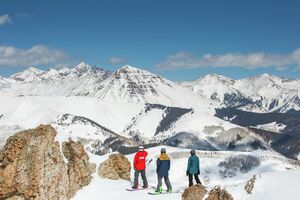
Crested Butte Resort is known for its 1,547 acres of challenging terrain. It offers 165 trails, with 37% designated as expert terrain, making it a prime destination for advanced skiers and snowboarders.
Snowfall and Conditions
Crested Butte Resort averages 236 inches of snow annually. The resort's snowmaking operations cover approximately 282 acres, primarily focusing on green and blue terrain to ensure early-season coverage and consistent conditions throughout the season. Before your visit, make sure to check the current snow conditions at Crested Butte.
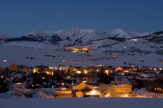
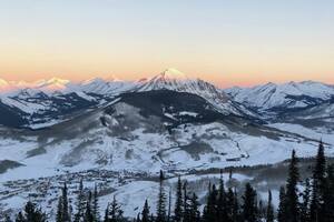
Winter at Crested Butte
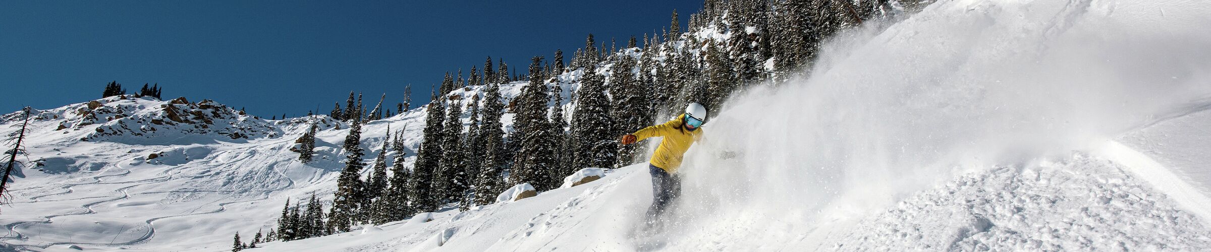
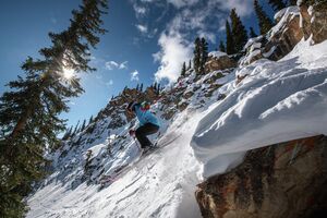
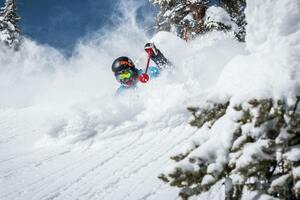
Nearly two-thirds of skiable terrain at Crested Butte is rated advanced or expert, accounting for roughly 561 acres of double-black-diamond runs. The resort is considered the birthplace of inbound extreme skiing in North America.
Advanced and Expert Lessons provide guided instruction on challenging terrain accessed by the High Lift and North Face Lift, including the Extreme Limits. Beginners and intermediate skiers and riders can focus on front-side slopes and groomed runs near the base.
Other winter activities include Nordic skiing and snowshoeing on more than 55 kilometers of trails, fat biking, dog sledding, winter horseback rides, ice skating at the Big Mine Ice Arena, and sledding near town. Crested Butte also offers cultural and leisure options such as art galleries, cafes, and local distilleries.
Winter Activities at Crested Butte: Skiing and Snowboarding, Private and Group Lessons for Adults and Kids, Cross-Country/Nordic Skiing, Snowshoeing, Dog Sledding, Fat Biking, Ice Skating,
Summer at Crested Butte
In summer, Crested Butte shifts to hiking, biking, and outdoor recreation. The resort and surrounding Elk Mountains offer extensive hiking trails for all skill levels. Hiking through wildflower meadows is a very popular summer activity; the area has unofficially been dubbed the wildflower capital of Colorado.
Mountain biking trails range from beginner-friendly paths to technical downhill routes, with lift access available for riders. Families can enjoy mini golf, climbing walls, and other outdoor games. Summer events include concerts, arts programming, and local festivals.
Summer Activities at Crested Butte: Mountain Biking, Lessons and Clinics, Hiking, Mini Golf, Climbing Walls, Scenic Gondola Rides.
Getting Around Crested Butte
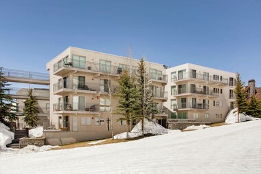
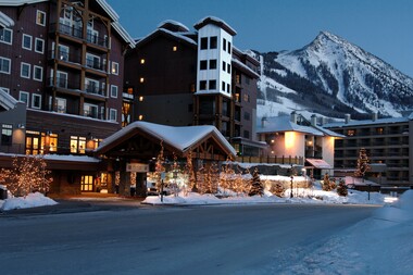
Crested Butte Mountain Resort is approximately 2 miles from the town of Crested Butte. A free shuttle service, the Mountain Express, operates between town and the resort, with buses running every 15 minutes during the ski season. Once at the resort, all lifts and trails are within walking distance of the base area.
What’s New at Crested Butte
For the 2024–25 season, Crested Butte added new terrain and introduced the Lower Twister Terrain Park. This new park is aimed at intermediate riders and features 25 to 35-foot jumps.

Crested Butte Resort is an Epic destination. Don't have an Epic Pass? Contact us!
1 - 888 - 676 - 9977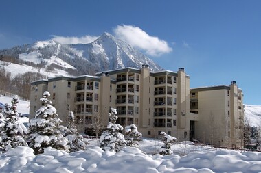
Getting to Crested Butte Resort
To get to Crested Butte, consider flying into Gunnison-Crested Butte Regional Airport (GUC), Montrose Regional Airport (MTJ), or Denver International Airport (DEN).
From Gunnison-Crested Butte Regional Airport (approx. 41 min.) Head north on 11th Street toward West Rio Grande Avenue; follow CO-135 N to 6th St. in Crested Butte (about 27 miles). Continue on 6th St., which will turn into Gothic Rd. Continue until Snowmass Rd. to reach the base of the resort.
Driving from Denver (approx. 4 to 4.5 hours) In the summer, the fastest path is to take Highway 285 south to Buena Vista. Straight ahead, you'll see Mt. Princeton. After that, head into town on route 24 and turn left at the stop sign to ascend Cottonwood Pass (route 306), which reaches a height of almost 12,000 feet. Turn left onto Route 742 and as you descend alongside the Taylor River you are surrounded by stunning rock and cliff formations. Another shortcut will take you onto Jacks Cabin Road, which turns to dirt for a few miles before meeting pavement once more. Turn right onto Highway 135. From here, it takes only ten minutes to travel up the valley.
During the winter, Cottonwood Pass is closed, and the route turns south from Buena Vista down to Poncha Springs. Turn right at the junction and hop on Highway 50 over the 11,000 ft Monarch Pass. Travel down the wide valleys to Gunnison, which is less than an hour's drive from the summit. In Gunnison, make a right at the stoplight onto Highway 135 and head north for another 30 minutes.